Introduction
The map of India is not just a simple drawing of boundaries. It is a visual representation of the country’s geography, diversity, and structure. By looking at the map, we can understand how India is divided, how its land is shaped, and how different regions are connected with each other. It plays an important role in education, planning, and daily life.
Shape of India
India has a very unique shape on the map. The northern part is wide, while the southern part becomes narrow and extends into the sea. Because of this, India is often described as having a triangular or peninsular shape. The country is surrounded by water on three sides, which makes it geographically special.
India is also one of the largest countries in the world. Its large size and distinct features make it stand out clearly on the world map.
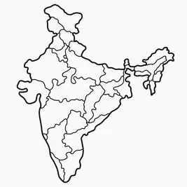
States and Union Territories
The map of India shows how the country is divided into different administrative regions. Currently, there are 28 states and 8 union territories. Each state has its own capital and system of governance.
The national capital, New Delhi, is an important location on the map. Other major cities like Mumbai, Kolkata, and Chennai are also marked and help in understanding economic and cultural activities across the country.
Physical Features of India
One of the most interesting parts of India’s map is its physical features. The country has a wide variety of landscapes.
In the north, the Himalayas form a natural boundary and are the highest mountain range in the world. These mountains protect the country and also influence its climate.
Below the mountains, there are large plains which are very fertile and suitable for farming. These plains are among the most populated regions in India.
The central and southern parts of the country include the Deccan Plateau, which has a rocky and elevated surface. In the western region, the Thar Desert can be seen, which is known for its dry climate and sandy land.
India also has a long coastline. On the west lies the Arabian Sea, and on the east lies the Bay of Bengal. These coastal areas are important for trade, fishing, and transportation.
Types of Maps
India has a very unique shape on the map. The northern part is wide, while the southern part becomes narrow and extends into the sea. Because of this, India is often described as having a triangular or peninsular shape. The country is surrounded by water on three sides, which makes it geographically special.
India is also one of the largest countries in the world. Its large size and distinct features make it stand out clearly on the world map.
Shape of India
There are different types of maps of India, and each serves a different purpose.
- A political map shows states, union territories, and their capitals.
- A physical map shows mountains, rivers, plains, and deserts.
- A climate map shows different weather conditions across regions.
- An economic map shows industries, agriculture, and resources.
Each type of map helps us understand a different aspect of the country.
Importance of the India Map
The map of India is very useful in many ways. Students use it to learn geography and understand the country better. It also helps travellers find directions and plan routes.
Governments use maps for planning roads, cities, and development projects. Maps are also important for security and border management.
Overall, maps help us understand how different regions are connected and how geography affects people’s lives.
India’s Position in the World
India is located in South Asia and holds an important position on the world map. Its location makes it a center for trade and cultural exchange.
Being surrounded by seas and close to many countries gives India strategic importance in global relations.